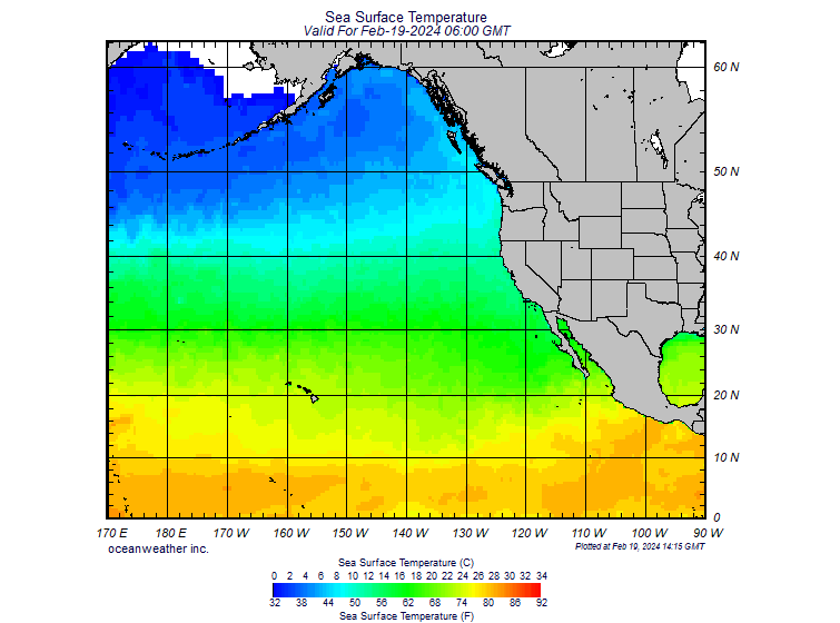
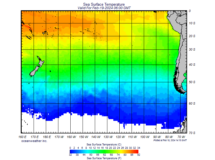
You can also check the current sea surface temperatures in the eastern Pacific area at the Equator to see how the sea is cooling faster than normal (a strong symptom of La Nina).
This cold water would be pushed towards the Indian Equator through the North and South Equatorial currents from the Pacific ocean through December to April if a La Nina truly sets in so by the summer of 2011, the Indian ocean will be cooler during summer of next year thank what it has been this year and than what is normal for an average year.
So what effect does a La Nina have on the rainfall patterns in India. My guess would be exactly the opposite of what has happened till now. This will definitely create a situation for increased precipitation over peninsular India which effectively means not only a normal monsoon but excessive rains over India because of the larger than normal precipitation. The reason will be solely because the colder water in excess will be pushed from the Pacific due to the potential La Nina causing a larger than normal high pressure area in the Indian Ocean causing higher moisture to be pushed to India because India would be having its summer during that time. Of course I cannot prove all this with data because all of this is to happen in the future but I would surely be tracking this and the movement of the precipitation through summer of next year and be posting about the same.
At an overall level, a La Nina causes excess rainfall in India which can very likely cause floods in the areas where India is experiencing droughts. This is generally the behavior since La Nina is just the opposite of El Nino hence the weather effects are generally the opposite. So I expect to see reduced rainfalls in parts of southern India (read farmer suicides in Telengana and Vidharbha). Northern and eastern India should have record rainfall which can very well cause floods given the state of the water management and infrastructure in our country. Western India generally should get the same amount of rainfall because the south west monsoons should behave normally unlike this year (see my earlier post on this topic).
You can get a simplistic and nice demonstration of the El Nino and La Nina effect with its effects on the weather and precipitation over here.
I only wish that the met department of India start following data such as these to correctly predict the movement and intensity or lack of monsoons such that the agriculture based economy of India can be better prepared for the shocks due to lack of monsoons or floods. Moreover these studies of the weather patterns and phenomenon would greatly help predictions regarding the arrival and timing of the monsoons to be correct such that the typical Indian farmer can plan sowing of crops to ensure better harvests helping to keep inflation under check. Hope we get some more satellites for study of weather patterns, ocean currents, sea temperatures over the Indian peninsula instead of having only satellites for watching stupid reality shows.
No comments:
Post a Comment